Who are we?
i-Topo is a solution born in the trenches… Developed and marketed by Lije Technologies, i-Topo was conceived by Julien DELAYE, a public works contractor who wanted to revolutionise site monitoring through photography.
We are based in Nouvelle-Aquitaine (FRANCE), specifically in Limousin, within a public works company’s premises, to stay as close as possible to the field and our users.
Lije Technologies was created in 2014, and since then, i-Topo has been continuously evolving.
i-Topo, French Tech certified
French Tech is the label awarded to French start-ups. It brings together a community of companies and initiatives that are helping to establish France as one of the world’s leading start-up nations.
Creation of Lije Technologies by Julien DELAYE, a public works contractor
Development of the BETA version and initial field tests - Original logo
Arrival of Gérald VERNADAT as Director of Lije Technologies and opening of our office at ESTER TECHNOPOLE (Limoges - FRANCE)
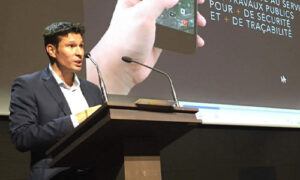
Development of i-Topo Version 1 in partnership with OD&B (LIMOGES) and start of commercial deployment
Commercial deployment of i-Topo and first paying account outside the Nouvelle-Aquitaine region
We surpassed the milestone of 500 created accounts and operate in more than 50 departments in France
Relocation to Couzeix (Haute-Vienne / FRANCE), strengthening of the sales team, and launch of i-Topo V2
More than 1,200 accounts created and we operate in 70 departments in Metropolitan and Overseas France
The team expands with the arrival of a technical manager. First paying account outside France (in Luxembourg)
We have a nationwide presence in France and surpass 2,000 created accounts.
Launch of the English and Spanish versions of i-Topo.
Our approach
On sites, almost everyone takes photos. But these photos are difficult to use because they are not geolocated, heavy to download or transfer and, most importantly, they lose
their value as they get lost in the depths of IT servers. With i-Topo, you will have a simple, user-friendly tool for collecting, classifying, and sharing your information.
The i-Topo objective
The primary objective is to simplify the management of site photos, making their collection, storage, use, and sharing easier.
Moreover, geolocating the photos helps reduce inaccuracies in site plans and the failure to identify certain networks. These errors often lead to incidents that can sometimes be hazardous.
That is why, later on, when he developed his own public works company, Julien Delaye imagined a platform made up of photos that would summarise networks, store them online, and geolocate them to keep a record of completed sites.
Photos enrich site plans. They provide information about soil composition, the environment, interactions between networks, and heritage features.
The i-Topo platform makes it easier to use photos by classifying and geolocating them. You can then share and retrieve them effortlessly by storing them on an intuitive, collaborative platform.
In addition to this collaborative approach, i-Topo has gradually become a digitisation tool for sites, saving time and improving efficiency both on-site with the mobile app and in the office with the web application.
The sites of the future
In an era of widespread digitalisation, companies need to rely on new tools. In the world of public works, more than in any other field, data has become a key factor in the successful management of sites.
As a result, i-Topo has positioned itself as one of the leading players in the illustrated geolocation market for underground networks and sites.
In the very near future, everyone working on sites will be connected via their smartphone. This transition into the digital world will enable companies and local authorities to share collected data in real time. One of the challenges is also to anticipate new requirements for photo reports, which will provide a higher level of information.
In this regard, i-Topo preserves a record of the underground environment through recorded information (geolocation, pipeline type, work dates, etc.).
Through photos, i-Topo provides a visual aid that helps the various people working on the site to understand the precise nature of the underground.